The second phase of the journey; after arriving at Mopah (WAKK) from northern Australia, I flew along the coast of Papua, then up through to the northern tip of Luzon, the largest of the Philippines islands, in five stages.

Flying along the coast of Papua, where the hills get higher, and the clouds get lower.


With real-world weather enabled, conditions change very quickly here. This was a storm I couldn't get round or under, but I fancied a bit of IFR anyway.

Rain effects on the windscreen and side windows - incredibly atmospheric.

Emerging from the rain, and in the background, Torpedoboot Island. Germany had a presence on the north coast of New Guinea before WW1, but this is well away from there, so I suspect the name has Dutch origins. Cloud reflections are a bit OTT, but the water is like a mirror, so maybe it's accurate.

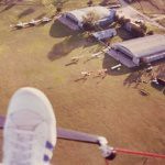
Morotai Island - during WW2, in the drive north to liberate the Philippines, the Americans landed either side of the peninsular centre-left, and built Wama Drome, lower right. It is now Pitu Airport, with a modern paved runway, but you can still see the old wartime runways running parallel on either side.

Crossing Lubang Island, which is opposite the mouth of Manila Bay. In those hills, Japanese Army Lt. Hiro Onada held out from February 1945 until March 1974, only surrendering when his former commanding officer arrived from Japan with written orders to lay down his arms. His book, 'No Surrender' is fascinating - for example, he watched the white cruise ships in Manila Bay, and explained them away as hospital ships carrying wounded from the fighting further north.

Lt. Onada coming down from the hills of Lubang after almost 30 years at his post.

Fort Drum, in Manila Bay. A very interesting piece of defensive engineering, created by the Americans in 1916. The white tower is a modern navigation warning light for shipping entering the bay.
https://en.wikipedia.org/wiki/Fort_Drum_(Philippines)

The island of Corregidor, just across the bay from Fort Drum. The American garrison under General Jonathan Wainwright held out here against the Japanese invasion of 1942, eventually forced to surrender on May 6th.

I'm now at Laoag airport (RPLI) right at the northern end of Luzon, ready for the flight to Taiwan. Unfortunately, just as one typhoon moved north another has taken its place, with what could be another two waiting in the wings. Looks like I'll be here for a while.