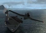
I have built the bare bones of the above airfield using AFCAD in FS9. For flattening and exclusion I used FSSC.
I now find that using FSSC to create a grass surface for the airfield my runways from AFCAD2 disappear and I cannot raise the runways to reappear. By the way the buildings (3 hangars and 1 control tower) installed using EZ Scenery remain but look ludicrous in a very large mown field of grass! I have removed the FSSC grass bgls. so that I can at least land and take off on what looks like the old wartime home of 106 Sqdn (Lancasters). That sqdn was the sole inhabitant of Metheringham for the final years of the war.
Can anyone tell me how to put the grass in place please. I find AFCAD2 very quick and easy to use but cannot discover a way to 'sow the grass' using that program.
Metheringham is situated between Coningsby and Cranwell and can be found on google earth quite easily. Not much left but the airfield does have a visitor centre and a good website.
Why 106 Sqdn? Once upon a time, a very long time ago, I was a cadet in 106(Orsett Hundred) Sqn ATC. In those days we still wore tunics buttoned up to the neck, sometimes were flown in Tiger Moths from Hornchurch and the RAF was everywhere!
Airfield Construction WIP RAF Metheringham
Moderators: Guru's, The Ministry
Re: Airfield Construction WIP RAF Metheringham
Might be worth using airport design editor from scruffyduck, John is a great guy and very helpful. It works with FS9 and FSX and is a realy easy to use program... And its free 
Ben.


- petermcleland
- Red Arrows

- Posts: 5201
- Joined: 25 Jul 2004, 10:28
- Location: Dartmouth, Devon
- Contact:
Re: Airfield Construction WIP RAF Metheringham
You make a shaped APRON from the runway edge to the next piece of concrete that gets in the way. There is an Icon to enable you to make shaped aprons in AFCAD. When you choose the surface for the apron you just choose grass. You may need quite a few of these aprons.hobby wrote: Can anyone tell me how to put the grass in place please. I find AFCAD2 very quick and easy to use but cannot discover a way to 'sow the grass' using that program.
If you look at any shot of McLeland Field, you will see that the aprons between runway and taxiways are Gravel...They could just as easily have been Grass
Regards,

http://www.petermcleland.com/
Updated 28/8/2007
My Channel
http://www.youtube.com/user/petermcleland?feature=mhee

http://www.petermcleland.com/
Updated 28/8/2007
My Channel
http://www.youtube.com/user/petermcleland?feature=mhee
Re: Airfield Construction WIP RAF Metheringham
Many thanks!
I downloaded ADE for FS9 - looks a super program with a long manual!
I decided to go with Peter's method for the present. I spent most of this evening making the parking 'spectacle' areas, all 34 of them with AFCAD2.
Tomorrow's FS time wil be devoted to growing 'grass' aprons.
Just need some AI Lancs marked as 106 Sqdn and then I shall be in business. Bit difficult here dodging Gr4s.
Re: Airfield Construction WIP RAF Metheringham
Historic WWII vintage or current?
If current don't forget the faded Hunter outside the visitor centre
If current don't forget the faded Hunter outside the visitor centre
- Chris Sykes
- Concorde

- Posts: 1658
- Joined: 18 Apr 2006, 11:50
- Location: Northampton
Re: Airfield Construction WIP RAF Metheringham
if you were doing it in FSX i would tell you two things you need... Google earth 5.1 (very important that its the old version for the old KML files) and FSX KML... I however am not sure if you can do it for FS9 but might be worth a try...
- petermcleland
- Red Arrows

- Posts: 5201
- Joined: 25 Jul 2004, 10:28
- Location: Dartmouth, Devon
- Contact:
Re: Airfield Construction WIP RAF Metheringham
When you start placing the dots for your grass aprons, overlap the edges of the aprons over the edges of the runways and taxiways...The overlaps will not show as the concrete runways will always be on top, thus allowing the sharp and accurate runway and taxiway edges to define the shape of your apron. You can also edit this aspect in AFCAD if you see a fault in the scenery when viewed in FS9...You can select just one of the dots in your apron and drag it under the runway/taxiway. Remember that such edits will not show till you have resaved your AFCAD file AND RESTARTED FS9!hobby wrote:Many thanks!
I downloaded ADE for FS9 - looks a super program with a long manual!
I decided to go with Peter's method for the present. I spent most of this evening making the parking 'spectacle' areas, all 34 of them with AFCAD2.
Tomorrow's FS time wil be devoted to growing 'grass' aprons.
Just need some AI Lancs marked as 106 Sqdn and then I shall be in business. Bit difficult here dodging Gr4s.
Regards,

http://www.petermcleland.com/
Updated 28/8/2007
My Channel
http://www.youtube.com/user/petermcleland?feature=mhee

http://www.petermcleland.com/
Updated 28/8/2007
My Channel
http://www.youtube.com/user/petermcleland?feature=mhee
Re: Airfield Construction WIP RAF Metheringham
RAF Metheringham. I have constructed the bare bones of the airfield - three hangars, one control tower. I do not have a WW2 drawing and I have not been able to find a 1944 plan on the web. All of my 'spectacle' dispersal pans are slightly incorrectly shaped, I broadened the top of the pan to allow easier taxying so the spectacles are not as diamond shaped as they were in real life.
All grass now in position, tedious making the 34 spectacle inserts! I cottoned on to Peter's suggestion to carry the grass under the taxyways and runways before reading his last email. Many thanks Peter.
My intention is to fly AI Lancs from this airfield in FS9 - I don't have acomputer that can run FSX.
Still fiddling about, I now have to put in the parking spots.
By the by, I have put in an ILS on the main 02/20 runway, which substitutes for a 'beam approach' system and the airfield has its own NDB and VOR/DME. I have read recently of bomber airfields having their own 'beacon' during WW2 but I don't know if that was a light beacon which flashed the airfield ID letters which were "MN" or whether it was a radio beacon transmitting the same letters. Anyone able to help there please?
This airfield looks a bit sparse and bleak for it is hard to discern the size and shape of buildings from a 1947 O/H photo and I suspect that the domestic sites were some distance and dispersed away from the airfield.
Usual problem, I have never learned how to put screenshots up on this website so cannot oblige.
As you can gather quite a bit more work to do although as is the airfield can be navigated to and ILS landings made, as no AI sqdn in residence yet I just taxy to the nearest 'loop' and park.
The photos on the airfield visitor website are not much help because they seem after almost 70 years to be in astate of ruin and their locations could be almost anywhere on the airfield.
The real fun comes in using Active Sky weather and flying into RAF MN from say Cranwell and then watching one's approach and landing from the cntrol tower view on the airfield.

