Hi gang,
I recently installed an add-on airport whose field elevation differs slightly with that of the FS2004 default airport. Needless to say my AI aircraft have failed to notice the difference and are operating at the default field elevation. Is there any way to adjust the field elevation that the AI aircraft are using? Any help would be greatly appreciated.
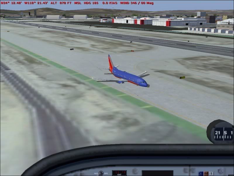
DispatchDragon wrote:looks like that 737 might be a little over MTOW
Leif
And with only 6885 feet of Burbank CA to play with, it's going to be a pretty dicey departure. Thanks for the help Dave and Garry, I appreciate it. Hopefully I can tweak it without making too much of a mess.
DispatchDragon wrote:looks like that 737 might be a little over MTOW
That'll be the weight of Brian's camera bag..............
Derek
'My Auntie Mabel told me I'd make a great soldier, though I don't know how 30 years working in a biscuit factory had qualified her to make that judgement.....' Eddie Nugent
No.. I bet he uses one of those posh 'pocket' jobs
Brain.. or should that be Brian? (genuine typo) Have a look at the airfield in Afcad and it will show at least 2 versions.. 1 being the original and the last one (higher number) being the one you're looking at. If there are any in between.. I'd bin 'em'/it Check the elevation data on the original and check the same against the new version. The answer should be a simple one but of course, if you're using scenery designed for the same sim version.. you shouldn't have to go through this hassle I take it the aircraft usually sit on the deck rather than in it.. or did do before you installed this scenery?
I had two similar elevation problems recently with newly added scenery and used this little program JABBgl to fix them. I had used it before long ago, but had forgotten about it.
I did read there was some kind of bug in FS2004 where new elevations in AFCAD won't overwrite the originals. So you have to edit that original value in its BGL. http://www.flightsim.com/file.php?cm=SE ... jabbgl.zip
It's in French, but they have kindly put in a button to click for the English.
It can take a little trial and error with guessing the exact elevation in meters, but the program does work a treat and is safe to use.
I'm with DG on this one - I tend to do a Windows search for the ICAO code from within the FS directory and find out if there's more than 1 AFCAD - if so, I normally delete the newest one provided the a/c have been behaving OK beforehand.
I had this problem a few weeks ago with the UKMIL (members) Sculthorpe scenery and landed one night and sank up to the fuselage. Turns out the MAIW Chinook package alsop has an AFCAD for this airbase as they still use it as a training site. Deleted the MAIW one and normal service was resumed