Posted: 12 Nov 2006, 08:00
Ian many thanks for your effort, as you say my AFCAD is probably very close to correct unfortunatly even with the wonders of google earth no visible evidence of the strip remain.
What with the ravages of time, erosion, new building,cultivation and a failing memory no sign remains, even if I went back I doubt if I would recognize any of it with so much progress there.
I think we can call it a day and I will keep my AFCAD as it is since it is my memory of it.
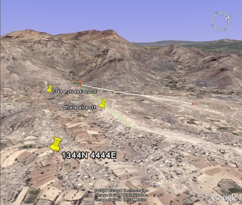
Seq10 I think is the nearest I think but the green line I added the red semi circle the turn around.
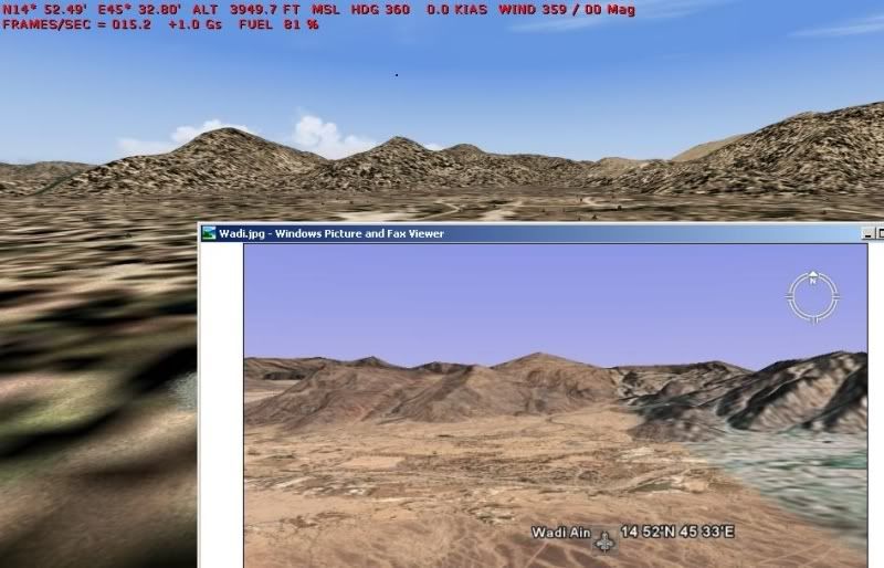
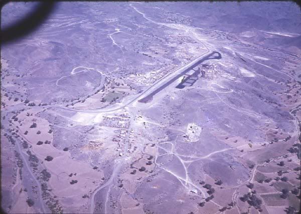
This is a set of Pics I found today this Bev has just landed as you can see by the distance to the mountains in the background and I think full flap setting, in the colour pic you can see a horizontal white line around the middle of the pic, I do beleive that is the turn around end of the runway
http://www.onceamarinealwaysamarine.co. ... nsend5.htm
Peter I do'nt think you would be happy to put a Venom or Hunter down there with that low quality talcum powder surface.
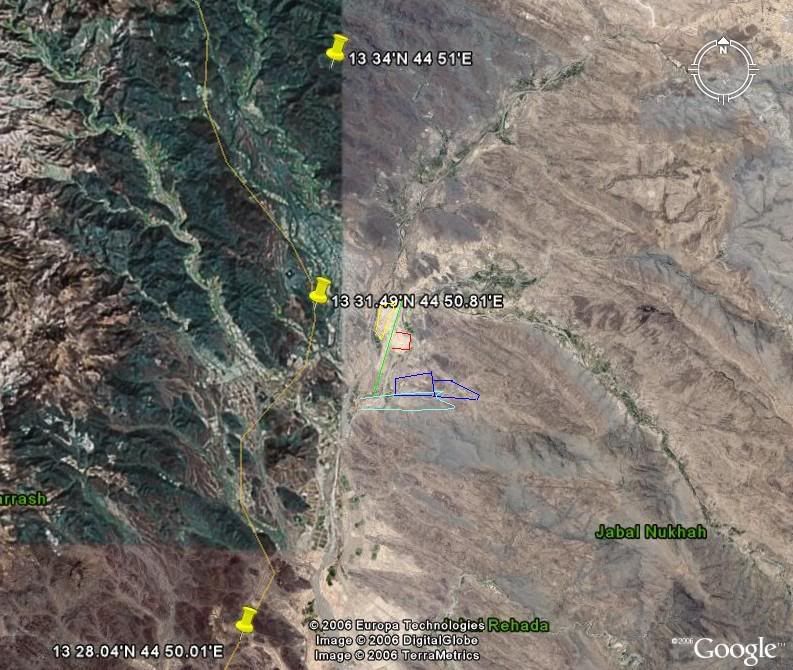
The problem with the info I originaly found on Dhala, Wadi Ain and Beihan was although they had altitude, runway length and one set of co ords I could 'nt be sure of the position of the runway, was the position in the middle of the runway or 1 of the ends and worst of all no heading.
Unfortunatly no info at all on Habilain I spent hours trundling up and down the Dhala road in the Stalwart (drove one for 18 months, I do believe the nicest cabby anytime) looking for likely spots hoping the Ms road is the same as the map I found.
Hope this has'nt bored anyone, Flight simming has many facets some of little interest to the majority, many thanks for your patience
What with the ravages of time, erosion, new building,cultivation and a failing memory no sign remains, even if I went back I doubt if I would recognize any of it with so much progress there.
I think we can call it a day and I will keep my AFCAD as it is since it is my memory of it.
Seq10 I think is the nearest I think but the green line I added the red semi circle the turn around.
This is a set of Pics I found today this Bev has just landed as you can see by the distance to the mountains in the background and I think full flap setting, in the colour pic you can see a horizontal white line around the middle of the pic, I do beleive that is the turn around end of the runway
http://www.onceamarinealwaysamarine.co. ... nsend5.htm
Peter I do'nt think you would be happy to put a Venom or Hunter down there with that low quality talcum powder surface.
The problem with the info I originaly found on Dhala, Wadi Ain and Beihan was although they had altitude, runway length and one set of co ords I could 'nt be sure of the position of the runway, was the position in the middle of the runway or 1 of the ends and worst of all no heading.
Unfortunatly no info at all on Habilain I spent hours trundling up and down the Dhala road in the Stalwart (drove one for 18 months, I do believe the nicest cabby anytime) looking for likely spots hoping the Ms road is the same as the map I found.
Hope this has'nt bored anyone, Flight simming has many facets some of little interest to the majority, many thanks for your patience
